Moped Trip website

Travels Around the Yukon & Alaska

Page 3 of 18
Previous    Next

Canol Road (Yukon) - Page 1


The Canol Road runs from Johnson's Crossing on the Alaska Highway northwest through Ross River to the Northwest Territories border in the Mackenzie Mountains.

This road was built during the Second World War along with an oil pipeline, from Norman Wells on the MacKenzie River to the Pacific Ocean.  The pipeline and road were abandoned shortly after the war ended. However, the portion of the road within the Yukon was kept up.

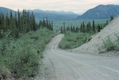
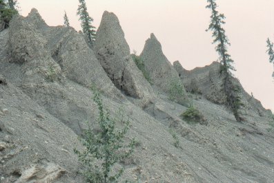
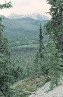
This is a small road, often more closely resembling a country lane that a highway.

I traveled the Canol Road south from Ross River, rejoining the Alaska Highway at Johnson's Crossing. This section of the road runs up into the Pelly Mountains, and is a very quiet trip of 138 miles.

Mile markers are measured from the Alaska Hwy.


This is the bridge that carried the oil pipeline across the Pelly River, near the town of Ross River.


The ferry across the Pelly River. The northern section of the Canol Road is only accessible via this ferry.

I did not travel that portion of the Canol Road.


Sunset on the Pelly River.


Lapie River valley, south of Ross River. The Pelly Mountains are in the distance.


Mile 134

Hoodoo erosion formations. These formations are typically found in dry climates. 

Most people don't realise that the Yukon actually has a very dry climate. The high St. Elias Mountains cut the Yukon off from the moist Pacific ocean winds, creating a rain shadow effect.


Mile 124

Lapie River valley.


Previous    Next


The material on this page is copyright © by the original author/artist/photographer. This website is created, maintained & copyright © by Walter Muma
Please respect this copyright and ask permission before using or saving any of the content of this page for any purpose

Thank you for visiting!