MOPEDTRIP.COM
The longest journey ever undertaken on a true moped (until 2007)
HOME
Intro & Overview
Heading West
Alaska Hwy
Dempster Hwy
Alaska & Yukon
Stewart-Cassiar Hwy
Heading East
How I Did It
World Record
Radio Interview
Articles
Moped Trips by Others
Links

Search

Email me

About this Site

1978 Moped Trip to
Alaska, Yukon, and NWT


Alaska Highway
(Page 1 of 15)
Previous    Next

While reading the commentary, please bear in mind that it refers to the Alaska Highway in 1978, NOT today!

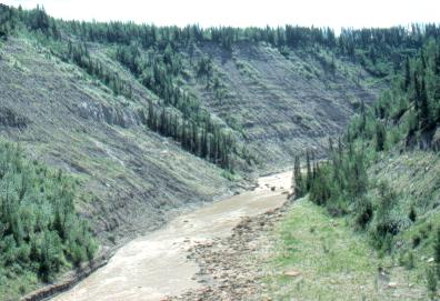
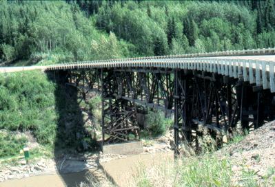
The Alaska Highway starts at Dawson Creek in mid-northern British Columbia (in Canada). This is known as "Mile 0".
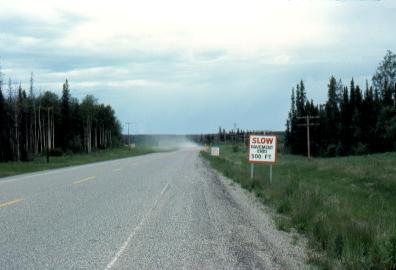
The first 90 or so miles are paved, then there's about 1000 miles of gravel road, all the way to the Alaska border, with just a few paved sections in between. 

The entire Alaska highway is now paved (2003). Although this means that it's a lot safer to drive, and one can get up to Yukon and Alaska a lot faster, most of the adventure is gone. It used to be a definite journey into a remote area of the country, along a sometimes difficult road, to reach those northern areas. Most of that sense of adventure is now lost.


Mile 20

This is the Kiskatinaw River.


Mile 20

Bridge over the Kiskatinaw River

This bridge is made of wood, and it visibly bounced as transport trucks drove over it!


Mile 33

The Peace River valley.

The Peace River is one of the larger rivers of Canada. It is the only river in North America to penetrate eastward across the barrier of the Rocky Mountains. It is often known as the "Mighty Peace".

There is farming and ranching in this area, as well as a lot of oil and gas exploitation.

The Alaska Highway goes downhill for 4 miles to reach the river itself.

Here the valley is 1000 feet deep!


Mile 93

The end of the pavement going north! 

Coming south, motorcyclists have been known to stop and reverentially kiss the pavement, the end of the gravel road that they've been traveling on for days.

From here, The Alaska Hwy is a gravel road for most of the next 1130 miles (1830 km)! There are only one or two paved sections in between.

In Alaska it becomes paved again (from Mile 1222 onwards).

(Remember this is 1978)


Mile 111

This is an old abandoned gas well head, called a "Christmas Tree" by those in the business.


Mile 160

Sikanni Chief River valley


Previous    Next


1978 Moped Trip
to Alaska, Yukon & NWT

The material on this page is copyright © by the original author/artist/photographer
This website is created, maintained & copyright © by Walter Muma
Please respect this copyright and ask permission before using or saving any of the content
of this page for any purpose

-- These other websites may also interest you --

Ontario Wildflowers   Ontario Trees & Shrubs   Ontario Ferns   Ontario Grasses   Ontario Insects
Mumart   World of Mosses   Wild Ontario   Trans-Labrador Hwy   James Bay Road   Rupert River   Moped Trip
Wildwood Survival   Wildwood Tracking   Leatherwood Trail   Tracker Trail   Earth Caretaker   Wildwood Canada

Thank you for visiting!