MOPEDTRIP.COM
The longest journey ever undertaken on a true moped (until 2007)
HOME
Intro & Overview
Heading West
Alaska Hwy
Dempster Hwy
Alaska & Yukon
Stewart-Cassiar Hwy
Heading East
How I Did It
World Record
Radio Interview
Articles
Moped Trips by Others
Links

Search

Email me

About this Site

1978 Moped Trip to
Alaska, Yukon, and NWT


The Stewart-Cassiar Highway

Introduction


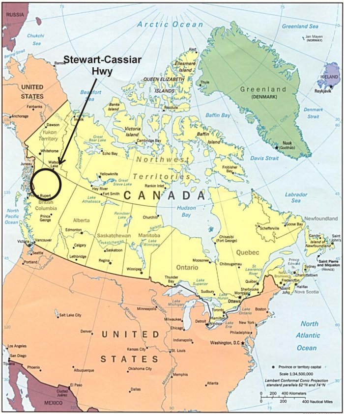
The Stewart-Cassiar Highway runs south from Watson Lake in the Yukon through a very remote part of northwestern British Columbia. There are basically only two towns along the road: Cassiar and Stewart (which is, however, off the main road).

The Stewart-Cassiar Hwy ends at Kitwanga, which is on the Yellowhead Hwy east of Prince Rupert, BC.

For much of its length, the Hwy more closely resembles a logging road, which is no surprise since it was pieced together using existing logging roads.

Previous    Next


Where is the Stewart-Cassiar Highway?


Map of the Stewart-Cassiar Highway


Previous    Next


1978 Moped Trip
to Alaska, Yukon & NWT

The material on this page is copyright © by the original author/artist/photographer
This website is created, maintained & copyright © by Walter Muma
Please respect this copyright and ask permission before using or saving any of the content
of this page for any purpose

-- These other websites may also interest you --

Ontario Wildflowers   Ontario Trees & Shrubs   Ontario Ferns   Ontario Grasses   Ontario Insects
Mumart   World of Mosses   Wild Ontario   Trans-Labrador Hwy   James Bay Road   Rupert River   Moped Trip
Wildwood Survival   Wildwood Tracking   Leatherwood Trail   Tracker Trail   Earth Caretaker   Wildwood Canada

Thank you for visiting!