|
Stewart-Cassiar Highway
Page 5 of 5
Previous
Next |
| |
 |
Continuing west along the Stewart
Road...
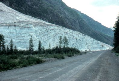
West of the Bear Glacier, the road passes
this enormous snowbank left over from the previous winter.
Remember that it is now Aug 12!!
|
|
| |
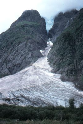 |
Another view of the
snowbank. |
|
| |
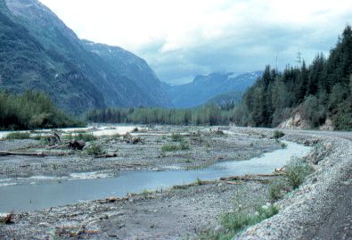 |
Down near sea level,
heading towards the town of Stewart, BC.
From Stewart I headed back east to the Stewart-Cassiar
Hwy and continued south.
|
|
| |
 |
Back on the Stewart-Cassiar
Hwy, heading south towards Kitwanga, on the Yellowhead
Hwy, where it ends.
Again, the "highway" is often simply a
logging road.
|
|
| |
|
After I reached the end of the Stewart-Cassiar Hwy, I turned east
and headed back towards Ontario. |
| |
|
Previous
Next
On to the
next section: Back to Ontario
|
|
|

