|
Dempster Highway
Page 5 of 8
Previous
Next
|
| |
 |
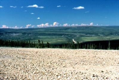
Finally the Eagle River
valley is reached,
near Mile 230. It's a
very deep valley: the highway travels downhill for about 5 miles to reach
the bridge at the bottom (not visible in this photo).
Somewhere
along here I saw three grizzly bears cross the road well ahead of
me.
|
|
| |
|

|
A long view
of an empty road. Traffic was very sparse on this road, and
the farther north I traveled the less traffic there was.
This shows the far-ranging views
typical of this stretch as the road travels along the ridge tops
across the Eagle Plain.
|
|
| |
|
 |
Mile 252:
The Arctic
Circle!
Highway construction crews had hung
up this huge old tire to mark the location of the Arctic
Circle. It was painted red, and people had carved their names
on it.
By now it has been
replaced by a more formal sign, one with considerably less
character.
|
|
| |
|
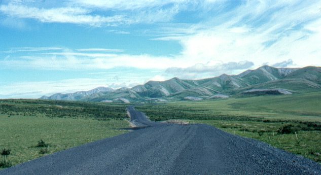
This is just beyond the Arctic
Circle. As the Dempster Hwy continues north it
approaches the Richardson Mountains, visible here to the
right. The Richardson Mountains are the
northernmost outlier of the Rocky Mountains.
This area is above the tree line, and
there are no more trees until the road descends to the Peel and
Mackenzie River plain. Again, the lack of trees makes it very
hard to judge distances.
The dark-coloured gravel is
picturesque. |
|
u
|
| |
 |
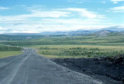
Mile 277.
Fifteen miles up ahead the Dempster
Highway crosses over a mountain pass through the Richardson
Mountains and continues into the Northwest Territories (NWT).
This is barely visible in the far distance.
It looks like it's cold up ahead
under those clouds that are mantling the mountains...it was! I
found this section of the Hwy to be in the worst shape, even though
it had just been completed. Permafrost heaving was probably
the cause of some dips that had the potential to wreck a car if one
hit the dip at a high enough speed. |
|
| |
|
Previous
Next
|
|
|